
Tent Ridge
Arguably one of the most iconic hikes of Spray Valley Provincial Park and only a two-hour drive from Calgary. This is an easy scramble with a respectable distance that includes scenic ridge views of Spray Lakes so be prepared for a beautiful day. Hopefully, my photos will do most of the convincing for you.
Trip Date: September 5, 2021
Time: 4-6 hours
Distance: 10.1 km
Elevation: 2515m
Elevation Gain: 652m
Hiking Difficulty (Shenandoah's formula): 169 Moderately Strenuous - Strenuous.
Technical Rating (Yosemite Decimal System): A handful of sections that are Class 2-3.
Best time to go: Jun-Oct
Toilets: N/A
Trail Popularity: Moderate-High
Food and H20: I finished 2L of water, a small snack, and a sandwich for lunch at the top.
Footwear: Hiking shoes or boots are recommended for scrambling.
Trailhead/Parking: Here
GPX download link: Here

Welcome to Tent Ridge!
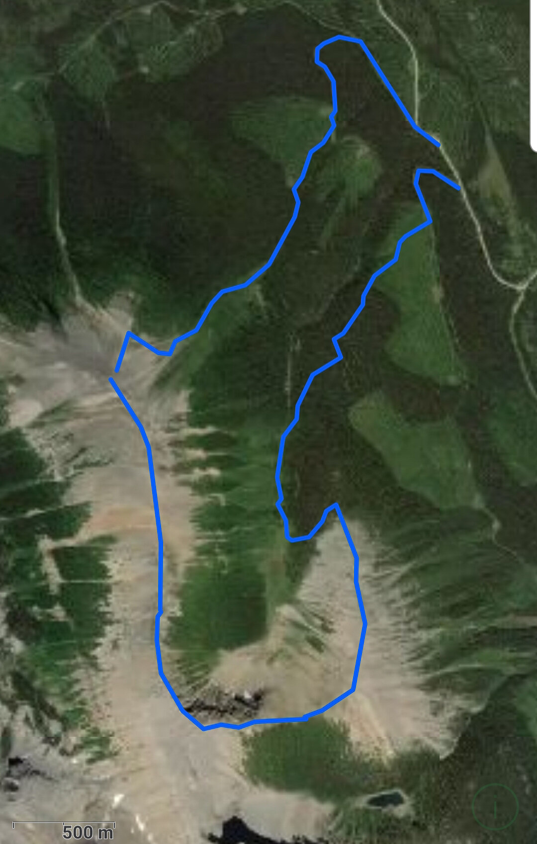
You will be completing a 10km loop that I reccomend doing in a clockwise route. The trail does have some small scrambling sections on the first ascent to the main Tent Ridge, its much safer going up on a scramble is much easier than going down but can still be done in counter clock wise route.

PARK HERE
Keep in mind the parking spaces are sandwiched by the trailhead, and where you will come back from.

This is what the trailhead should look like assuming you are doing the clockwise route like we are.


From the trailhead to the first important fork that leads you to Monica Brooke Meadows is exactley 514m.
This first part is where many people will get lost, just keep in mind that the trail makes a big U shaped left curve and you’ll know if you’ve gone too far if the trail continues straight.

Here it is! Giant arrow on the ground is quite obvious, if there is snow you will have to keep an eye out for the orange trailmarker.

If you’re lucky you will see wild flowers dominating the first quarter of the trail.


Treeline thins and Tent ridge will be more visable.

View of Monica Brook Meadows. The trail will continue to a sharp left of your screen. You will be heading to a smaller tree-dense area as you make your way uphill toward the first ascent of the first peak.

East views from the first ascent. Mt. Engadine, The Tower, Mt. Galatea, and The Fortress are across the valley.

As you make your way up you will be greeted with this terrain. Be prepared for 250m of a steep ascent.
You will need to use your hands occasionally while scrambling here, keep your distance from hikers in front of you as they can accidentally kick rocks towards you.

From the treeline right to the tip of the first ridge is the distance of the short scramble. It may seem quite intimidating for the cautious hikers but believe me, it is worth it!

The fatigue in Darren’s face says it all.

Welcome to the first peak of Tent Ridge, This marks 3.8 km of your trip so far and only another 6.2km left to go.
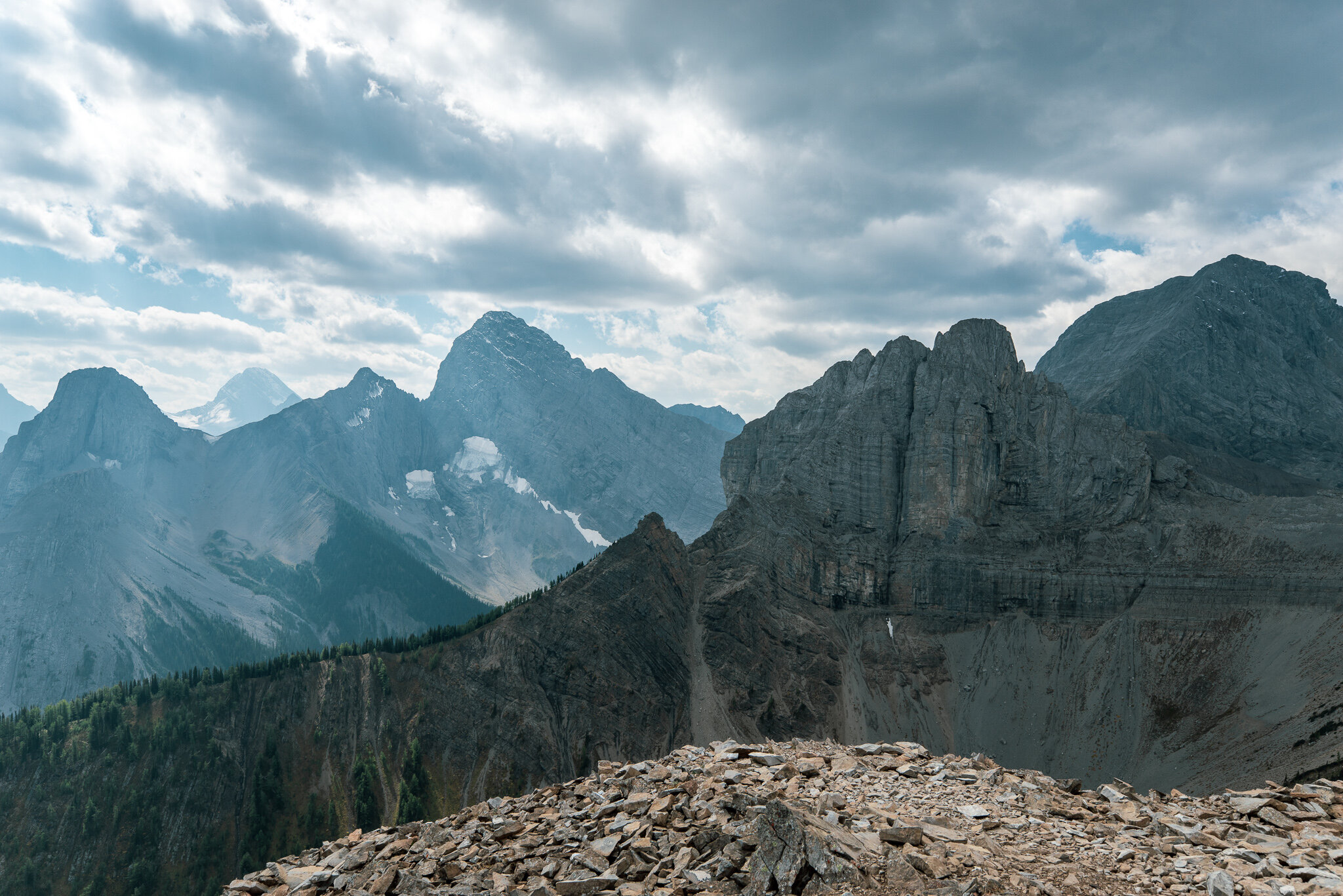
This is the southwest view overlooking The Fist and Mt. Smuts.
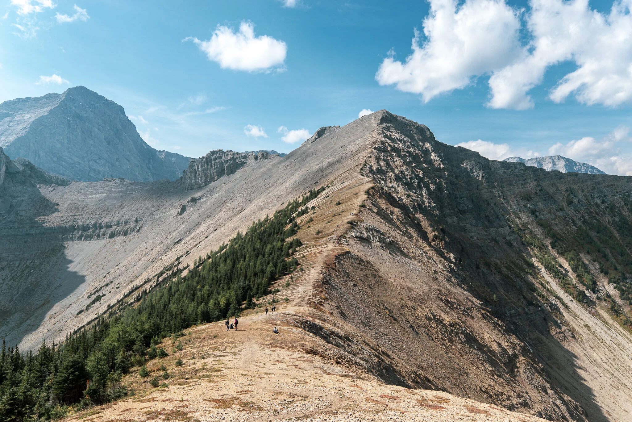
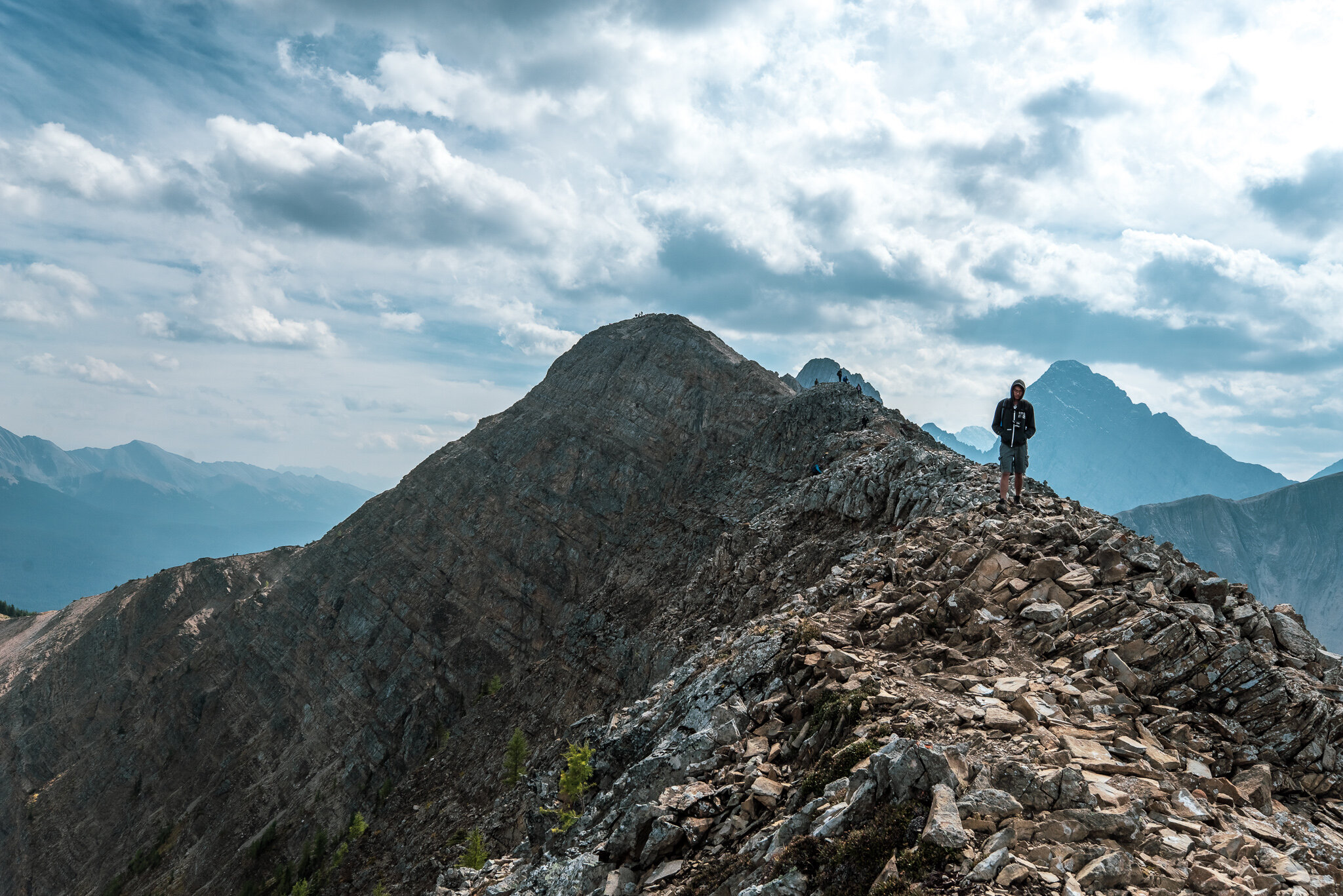
800m west is the main peak of Tent Ridge, you will dip down to the col as you begin to make your way up.

View looking north at Mt. Turner and Cone Mountain. Tent ridge continues to the right of your screen to the final third peak.

Celebratory photo with Darren and Michael!
We will head towards the third peak for another 2km, this is also my favorite part of the ridge.
Looking back at the main peak, you can see some other hikers on the summit if you look closely.

Amazing views from peak 2 to peak 3, this is what ridge walking is all about!

Peak 3 is in view on the right of your screen. Be prepared for strong gusts of wind.

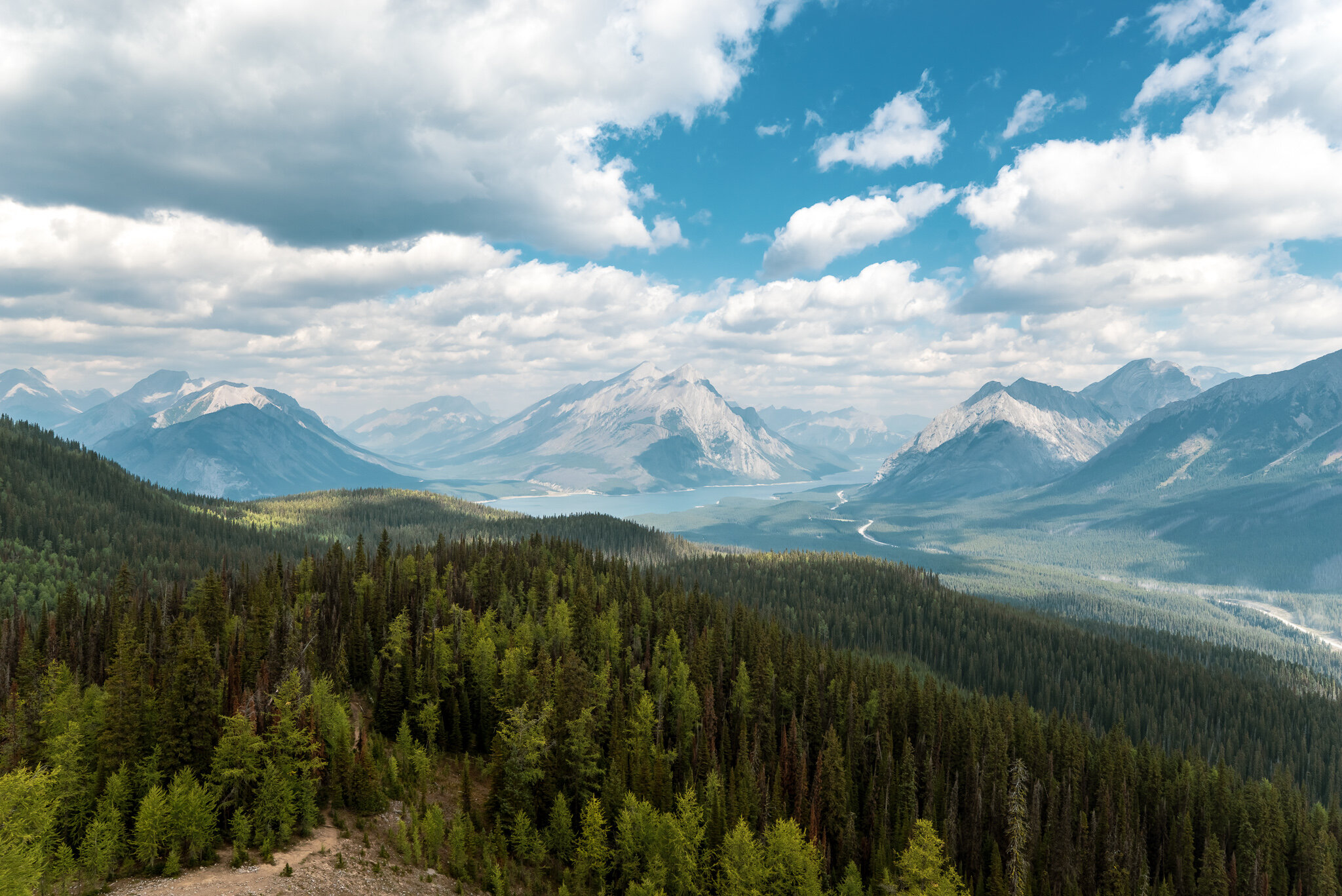
Looking northeast from the third peak. Spray Lakes is looking mighty gorgeous.
Your descent towards the parking lot begins here, the final 3.3km. Be prepared for some muddy sections.

The steepest descent will be immediately after peak 3, here’s what it looks like.

As you walk northeast from peak 3 (for about 3km) you will eventually exit out of some dense forest and will end up at this old service road. The service road marker is the final leg of your journey and will be about 650m to the main parking area.

Thank you for reading this guide and thank you for joining me today.
Hope you have a great time at Tent Ridge and as always, please stay safe!