
Smutwood Peak

Smutwood peak is located in the Spray Valley, next to Mount Engadine Lodge and off of Highway 742. This Summit can be accessible year-round and easily navigated with its well-defined trails, it is listed as very strenuous due to the total distance and easy scrambling to get to the top, it also offers amazing 360 views and the iconic view of Mt. Birdwood as seen in the main photo of this post.
Trip Date: Aug 22nd, 2020
Time: 8-9 hours
Distance: 18.8km
Elevation: 2693m
Elevation Gain: 950m
Hiking Difficulty (Shenandoah's formula): Very Strenuous (270)
Technical Rating (Yosemite Decimal System): Class 2 “Simple scrambling, with the possibility of occasional use of the hands. Little potential danger is encountered. Hiking boots highly recommended. “
Best time to go: Year-round but I recommend July-September.
Food and H20: I drank a full 4L tank and was still somewhat dehydrated. I had 2 chicken wraps, a bag of beef jerky, 1 nuun tab, some mango candy and 2 granola bars. The hungry Mountain Man was more than satisfied.
Footwear: Hiking boots or hiking shoes recommended. Your nice running shoes might not survive the trip .
Trailhead/Parking: https://goo.gl/maps/tVzissDfysUASzWn8
I’ll be honest, Researching this hike was somewhat of a pain. I read on a few other blog posts that this hike was “easy” or “Beginner” as well as seeing 3 other options for trailheads that all require you to unnecessarily bushwack for 5km… somewhat baffled at the variance of difference in opinions as I found this hike NOT EASY. I don’t know if it was because my legs were extremely sore that day from lifting weights but there is absolutely no way this is easy! Sorry if we’re all regular people and not ultra-marathon runners but how can you finish an almost 20km hike IN 4 HOURS?!?!?!? There’s no way!!! Sorry rant over, Here’s how I really feel about this hike:
Smutwood Peak is an extremely beautiful hike, with picturesque scenery everywhere you look. For the most part, this hike is somewhat flat until the last third where you will notice a good leg burn and an increase to the elevation gain. The trails are well defined as long as there is no snow, One thing to note is the narrow summit in combination with strong winds that may not be suitable for those scared of heights, there were a few times I had to squat down to get in a lower position to maintain my balance. There are lots of loose rock mixed in with some great foot placements and some more sharp rocks (great for handholds) so the scramble can be navigated with ease as the technicality is quite manageable than other scrambles out there. I was fortunate to have some gardening gloves (rubber coated finger and palms) which made the scramble much easier, other people on the hike were complaining of cold hands from the old wind which made it harder for them to be confident in their hand placements so be prepared.
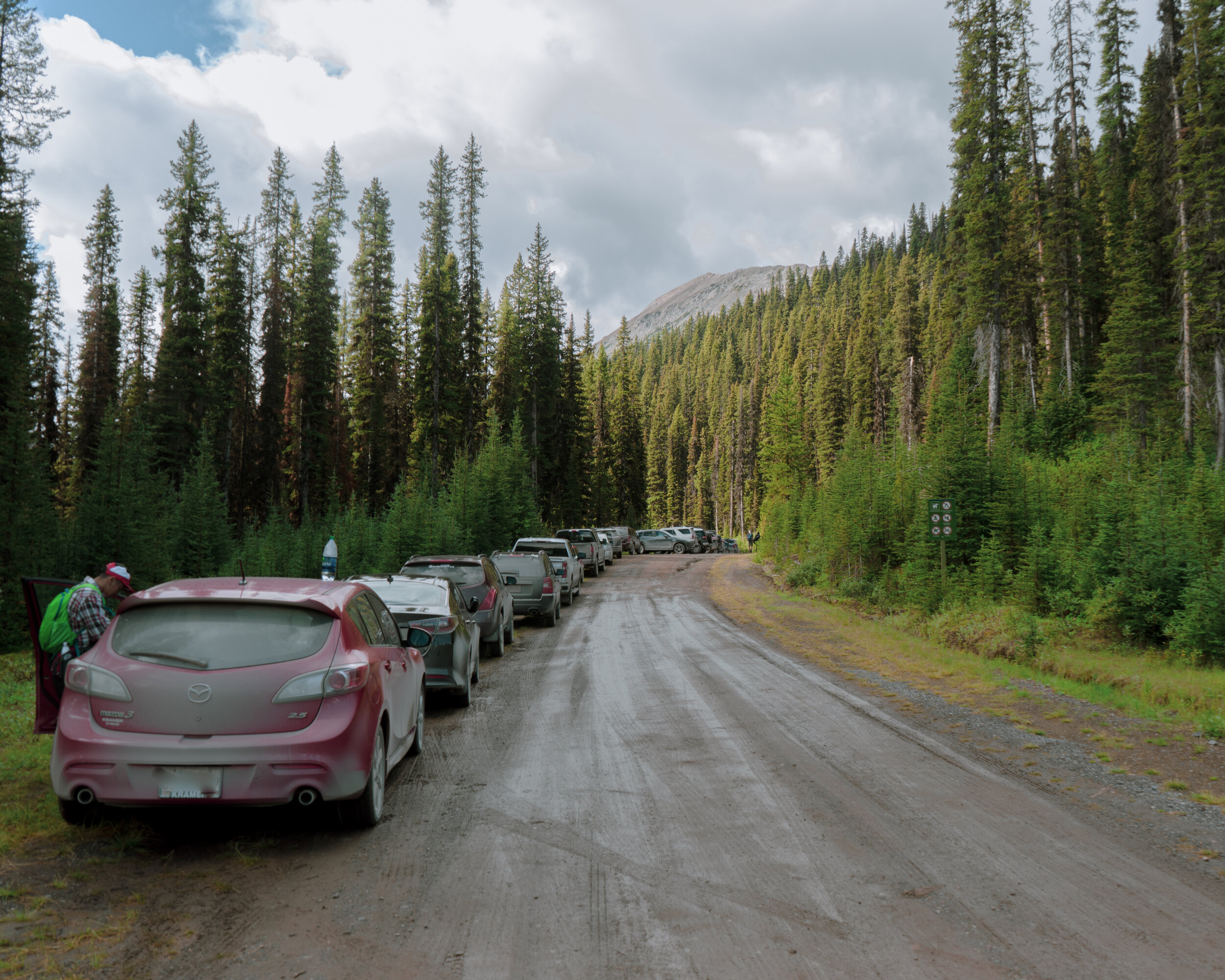
We arrived at the trailhead ( https://goo.gl/maps/tVzissDfysUASzWn8 ) at 9:00 am and was somewhat surprised at how many cars were here, I guess Tam and I are late to the party!

The trail begins at the south end of the parking lot. A nice flat 3km walk begins on this old service road.

As you approach the 3km mark you will see this amazing waterfall! Be ready for a long exposure shot to add to your photo library!

This section of the trail continues along this stream for another kilometer after the waterfall, expects muddy areas and lots of roots so watch your step.

The treeline will eventually break, from there you will be greeted with this open valley and views of the ascent towards Smutwood pass will appear. The elevation gain to Smutwood pass will be at approximately the 5km mark.

Looking east at the journey so far.

The ascent to Smutwood Pass begins, Continue for 1km to Smutwood Pass.

“I like that boulder, that’s a nice boulder” - Donkey
(Looking south, the direct opposite of Smutwood pass)

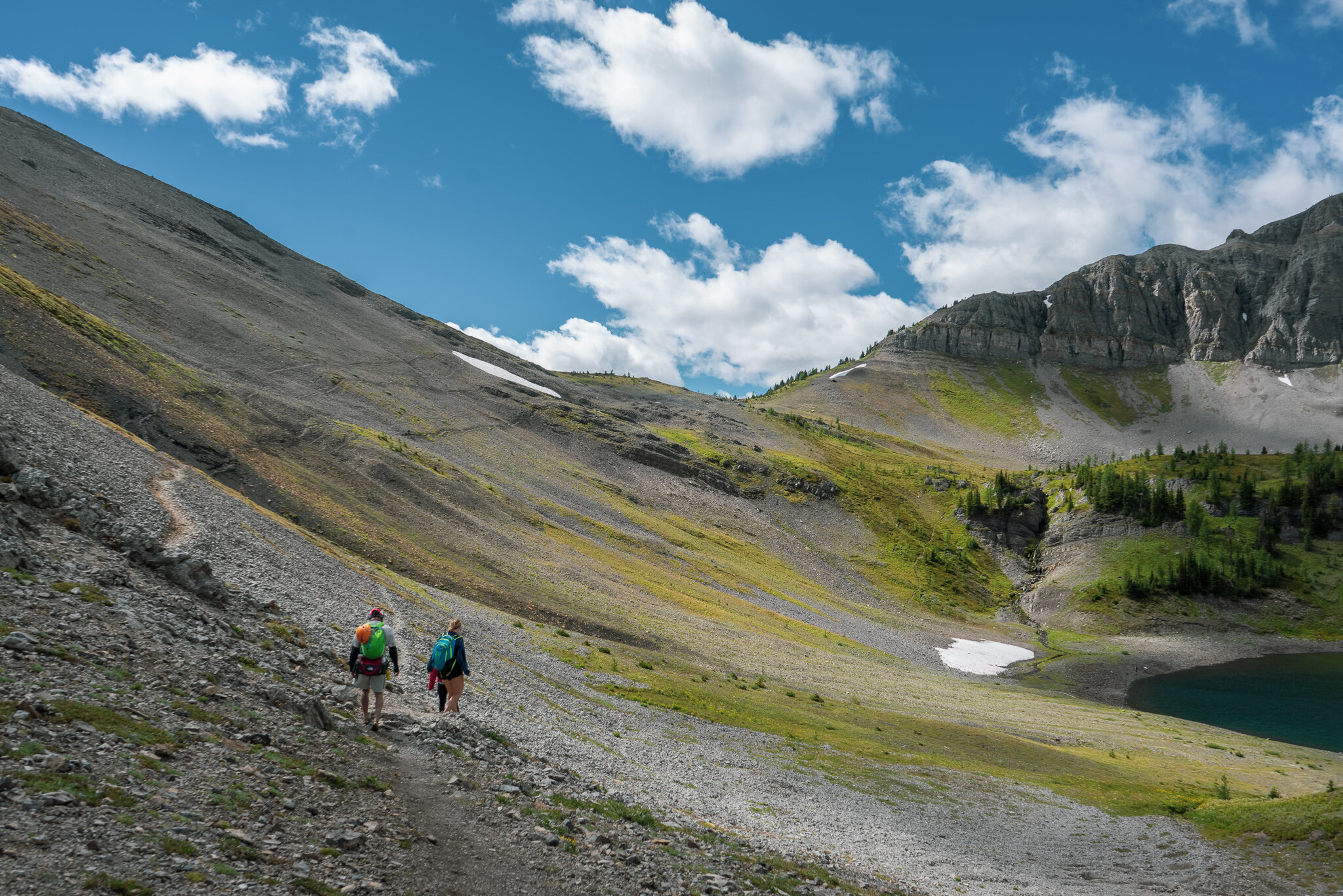
Despite all of the loose rock, the trail is well padded down making it a quite pleasant route to Smutwood Pass.

Smutwood Pass! Continue for another 3km to a great viewpoint and rest area.
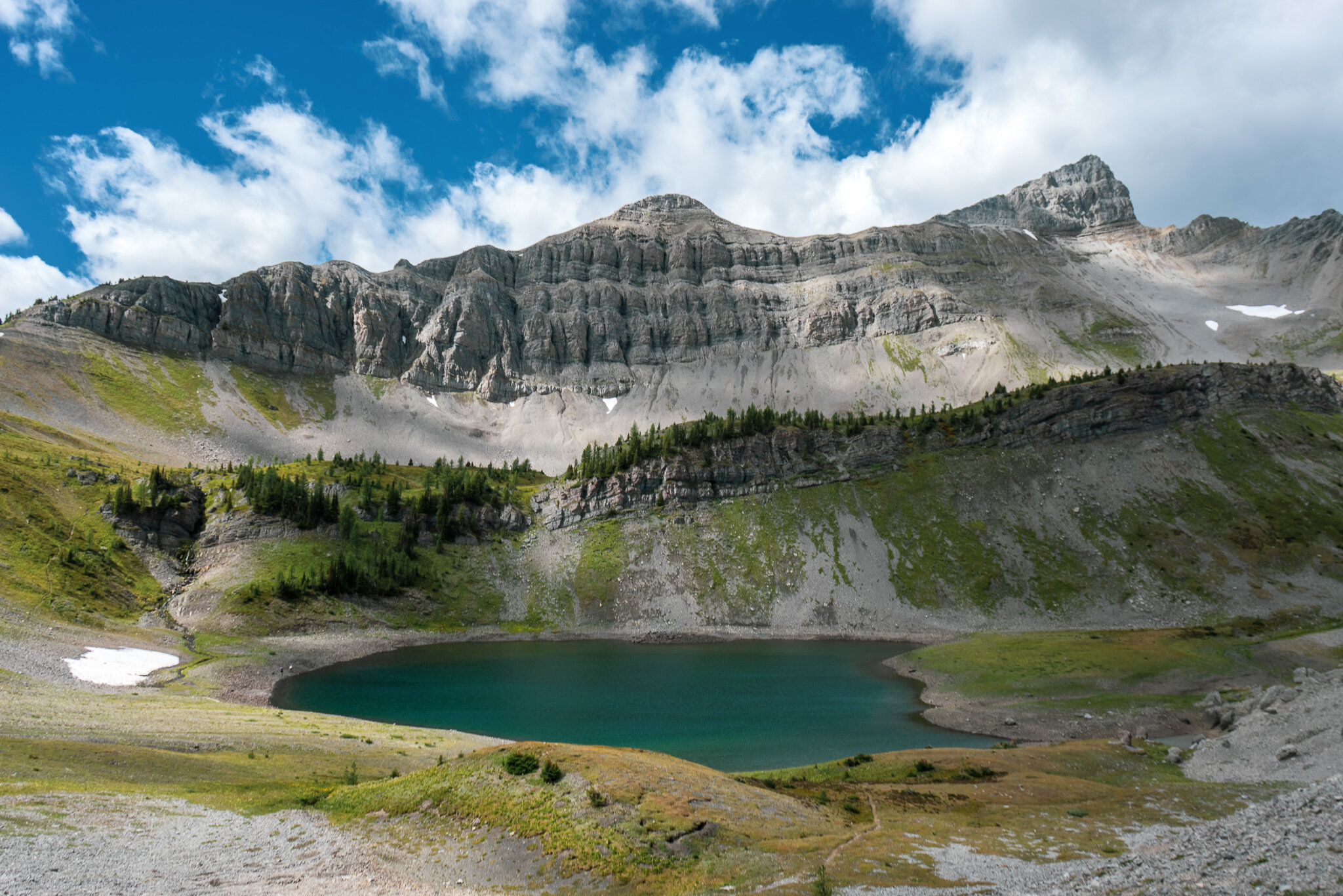
After reaching the pass, views of the first lake appears. We saw some brave souls going for a nippy swim. The Smutwood Peak Summit is just off to the right.
We then continued left of the first and second lake, the trail is quite obvious and makes a great preview to the final ascent to Smutwod Peak.

Looking back at the Smutwood Pass to make sure we’re not being followed by a bear (kidding).

You are now at the 8km mark, this is a great place to rest and have lunch before you scramble up to Smutwood Peak.
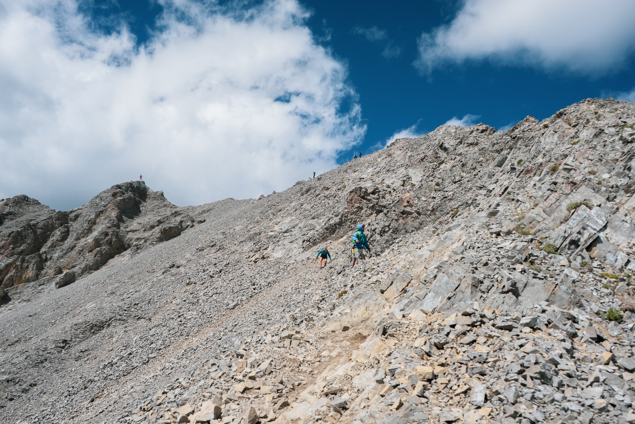
The final scramble. This is where the technicality can be listed as a class 2. Tam and Cara went a bit too far to the left and decided to take another route, I recommend scrambling a bit closer to the right side but not too close to the edge. You’ll encounter some loose rock and may or may not need to use your hands to get up.
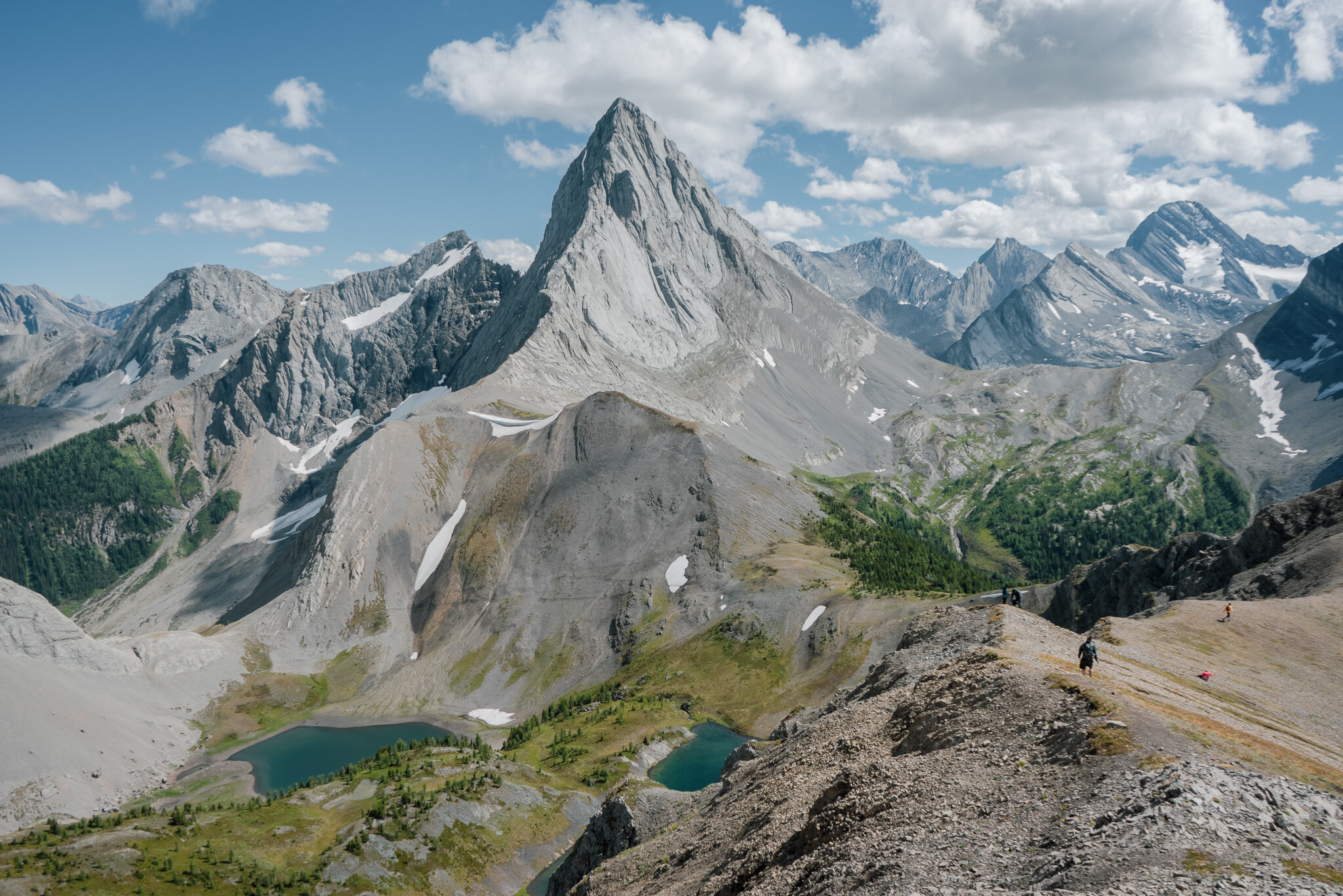
From the summit! This is a south view of Mt. Birdwood and the trail leading up.

West/North West views from Smutwood.

Northeast view of Mt. Smuts.

Thanks for joining me today you guys, I hope you have a great time on Smutwood Peak just as Tam and I have.
Looking forward to reading your comments, let me know what you think <3