
Cirque Peak
Cirque Peak is an insanely breathtaking summit located in the Bow River Valley of Banff National Park. Getting to Cirque Peak requires you to pass Helen Lake and the Helen-Kate Ridge before the final ascent, Expect a well-marked lost proof trail, a long day, steep incline with loose scree, and a technical scramble at the top to finish the summit for some amazing 360 views. Easier options are available as well.

Summit of Cirque Peak looking south. Lake Helen on the right, Lake Katherine to the left. Dolomite peak on the left above Katherine as well.
Trip Date: Aug 31st, 2020
Time: 8-9 hours
Distance:16.3 km
Elevation: 2993m
Elevation Gain: 1000m
Hiking Difficulty (Shenandoah): Very Strenuous
Technical Rating (Yosemite Decimal System): Class 5 - Exposure at the summit, steep hiking on loose scree leading up.
Best Time To Go: July-September
Toilets: Yes, An outhouse is located in the parking lot.
Trail Popularity: Moderate-High depending on weekdays vs weekends.
Food and H20: I packed 4L of water, finished all of it, Had a submarine, 2 pepperoni sticks, 2 granola bars, and a banana. I was well hydrated and well energized.
Footwear: Hiking boots highly recommended.
Equipment: Scrambling helmet not necessary but recommended for confidence if needed. Hiking poles would be great for this hike, you’ll have to put them away once you’re closer to the top. Spikes and snowshoes are a must during the winter and spring.
Trailhead/Parking: https://goo.gl/maps/cWeqAEcn5qSVoVKz7
The easier option if you’d like to get home earlier is to go to the Helen-Kate Ridge or just Lake Helen, The ridge and the lake are very close to each other within 200m and offer a difficulty rating of Moderately Strenuous vs Cirque Peak’s Very Strenuous. The round trip to Helen-Kate Ridge will be 10 km and should take you around 5-6 hours.

It took us about a 2 and a half-hour drive from Calgary arriving at the trailhead at around 9:30 am, somewhat surprised at how packed the parking lot was by the time we got there.
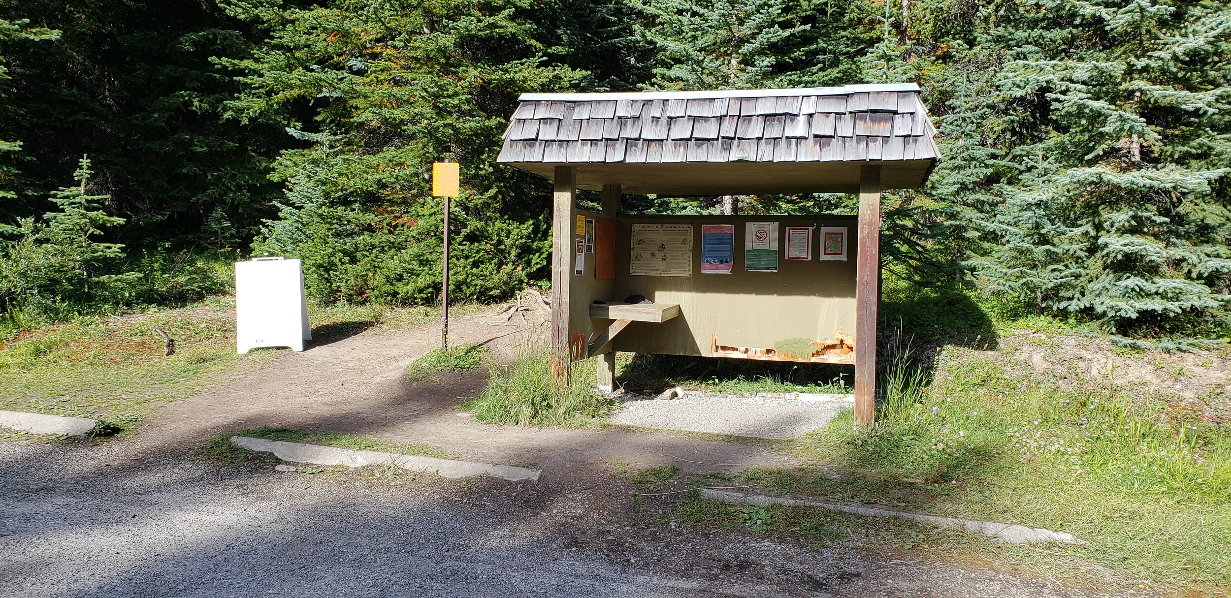
Trailhead located at the north end of the parking lot, make sure to familiarize yourself with the attention notices before you head out!
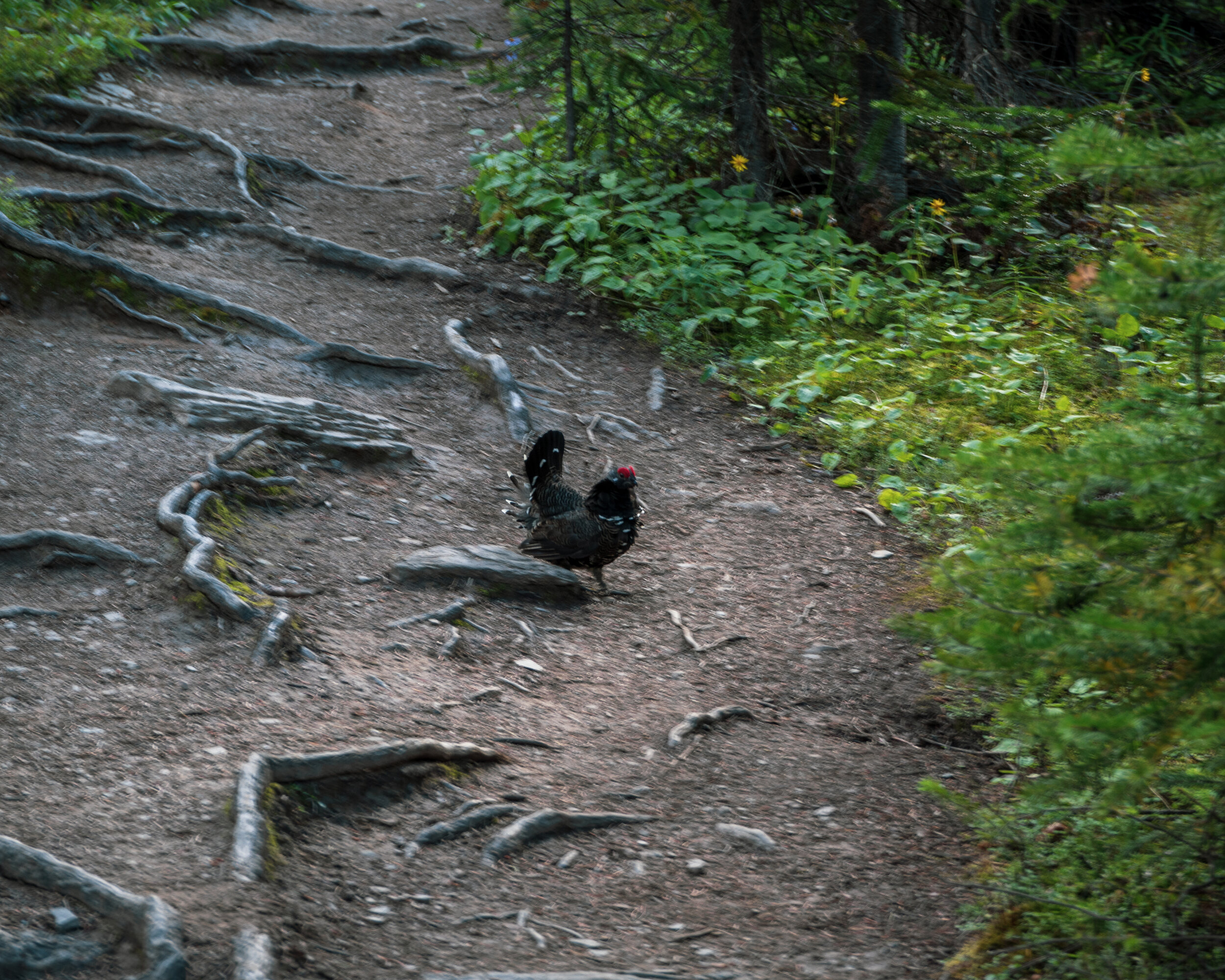
In the first 3km, there will be surrounded by thick forest and some uneventful activity. We saw a Grouse (or a Ptarmigan?) and a few streams along the pathway.

At the 4km mark of the hike, you will begin to exit the tree line and will be greeted with views of Dolomite Peak and some amazing wildflowers (hopefully you get a chance to see them in season).
Cirque Peak to the right, now approaching the 5km mark and within 1km to Lake Helen.

Great spot for a mini-break, don’t sit too long though because we still got lots to go.
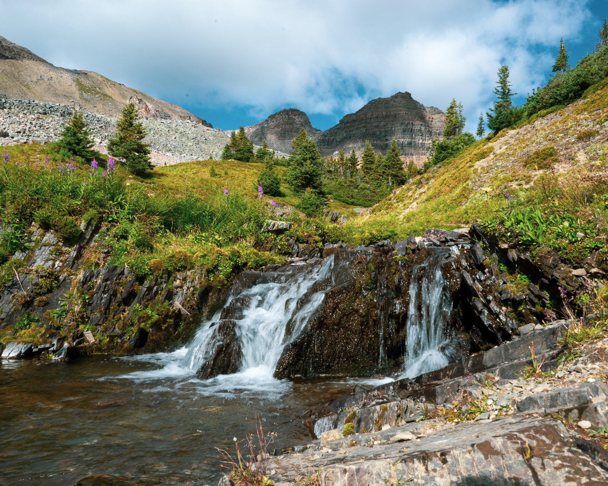
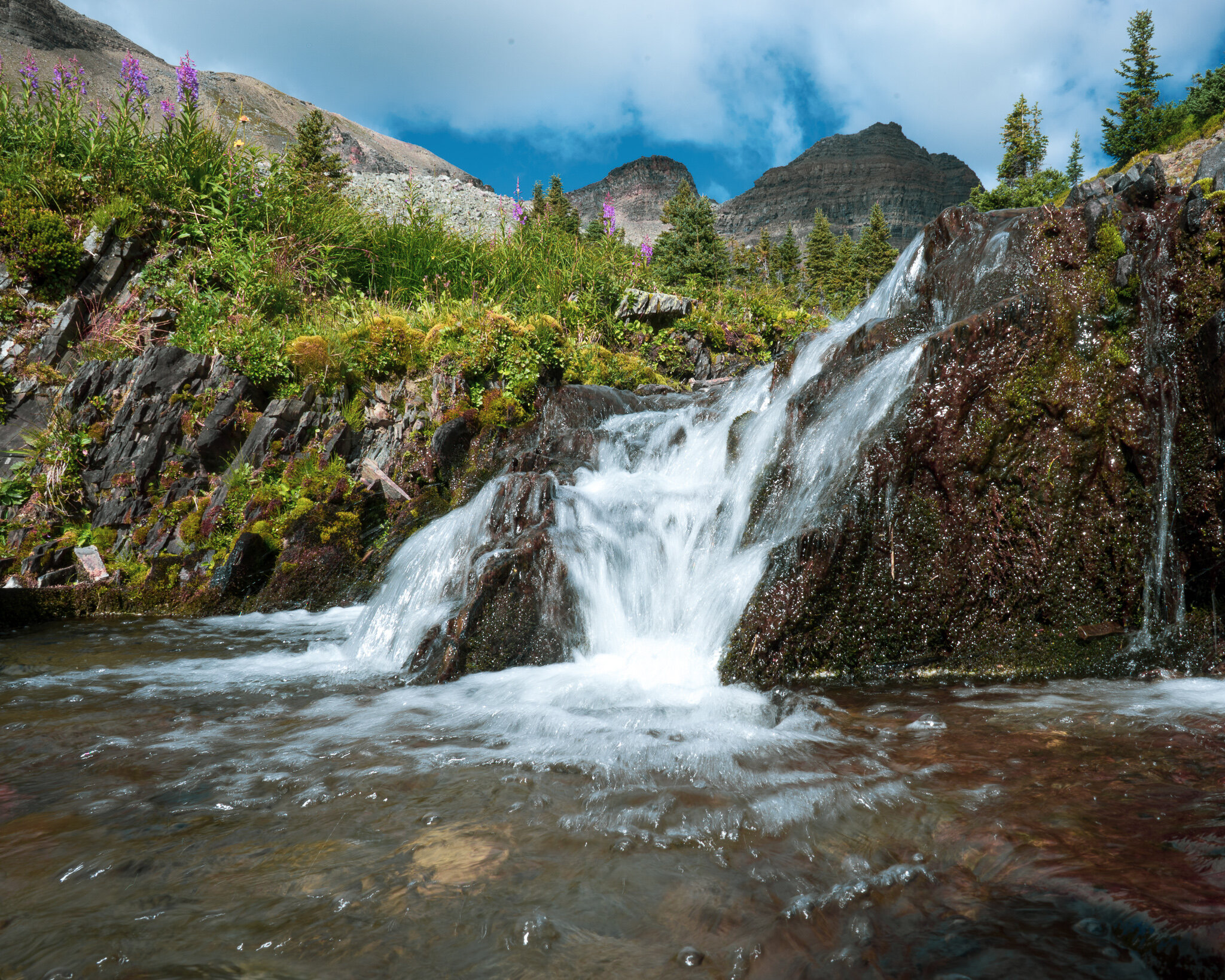
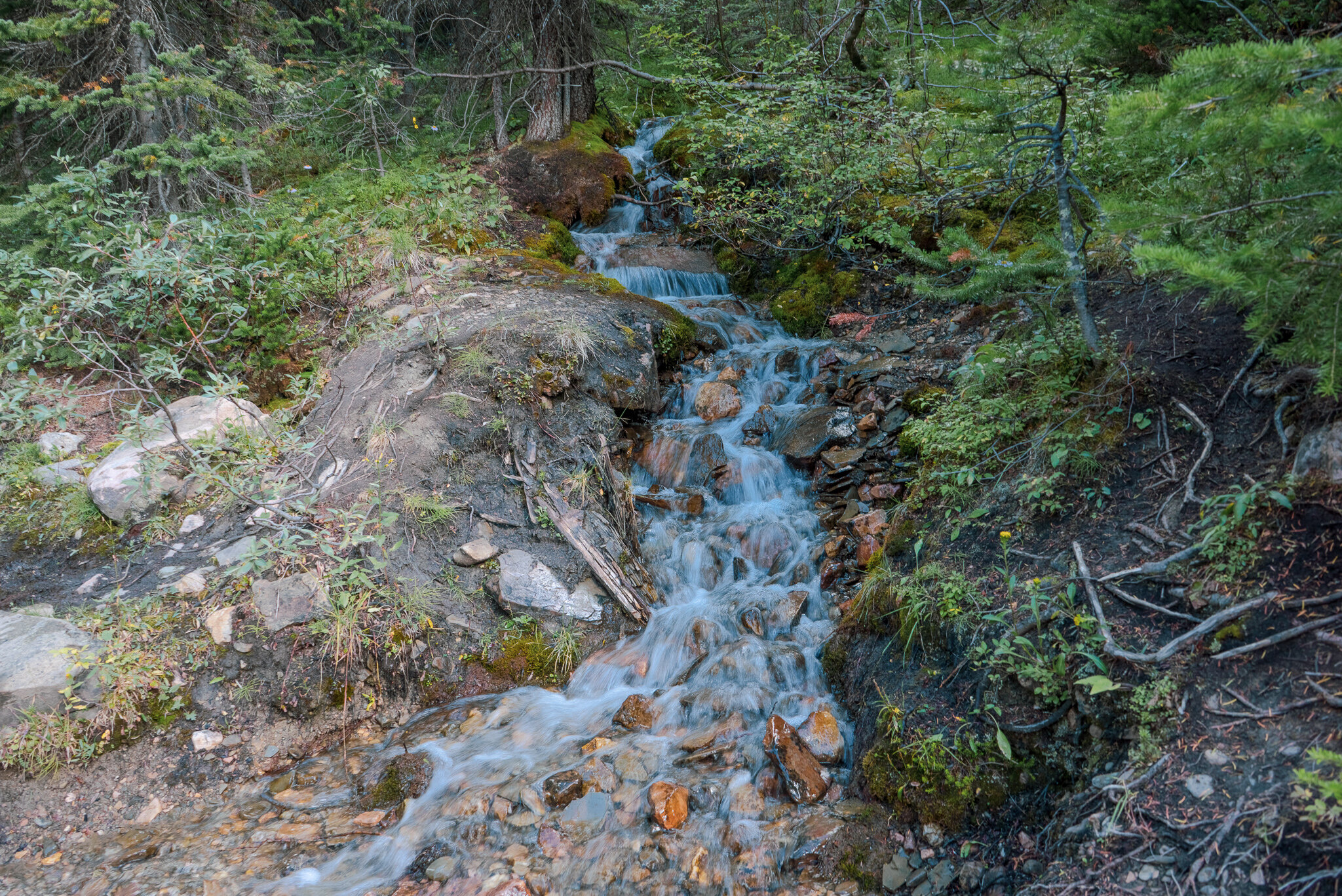
Close-up look at the waterfall.


Dolomite Peak off to the east.
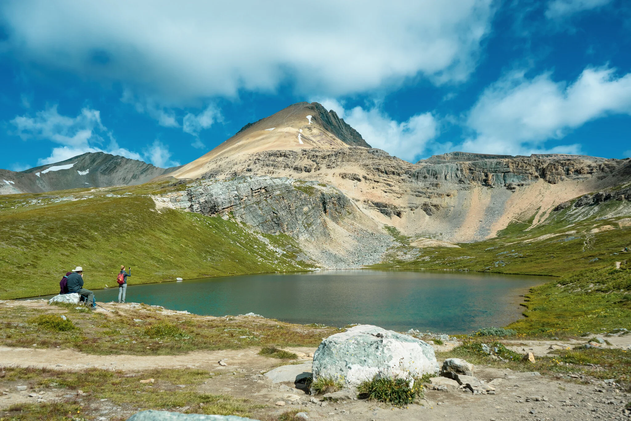
We’re here! Welcome to Lake Helen. It’s been 6km thus far, this is a great spot to have a quick bite or some lunch, you’ll need the rest because we will begin to ascend the Helen-Kate ridge and Cirque Peak.

Looking south a Lake Helen and Crystal ridge in the background.

Making our way to the Helen-Kate ridge. If you look closely you can see the trail zig-zag to the right.

Ascending the first ridge before the main Helen-Kate ridge.

An important fork will approach the first ridge, you can see the group of 3 in the center of your screen.

Once you get to the first ridge you will notice a trail going to the right in red, avoid it you don’t need to go there. Pick the green path as it is straight forward, you will avoid unnecessary scrambling and will take you right up into the middle of Helen-Kate ridge.

View of the east looking down at an unnamed lake and Oxo Peak in the background. Lake Katherine is just hidden but you can see the north tip of it peeking through the center of your screen.

Looking southeast with a full view of the Helen-Kate ridge and Dolomite Peak. The entrance is just to the right where the person with the hood is.

And so it begins… The final moments before we ascend Cirque Peak. Jamie looks back to make sure I’m still alive.

A Marmot! I was somewhat surprised at how big they are, They’re like beaver sized golfers! So cute.

If the steep incline doesn’t slow you down enough, the terrain is another bonus.

I made it to the top and this is the safest spot for me to take a photo. Just below where these guys are you’ll be doing some pretty technical scrambling, make sure you have some distance to your hiking partners so you don’t kick rocks at them but also be sure to spot each other.
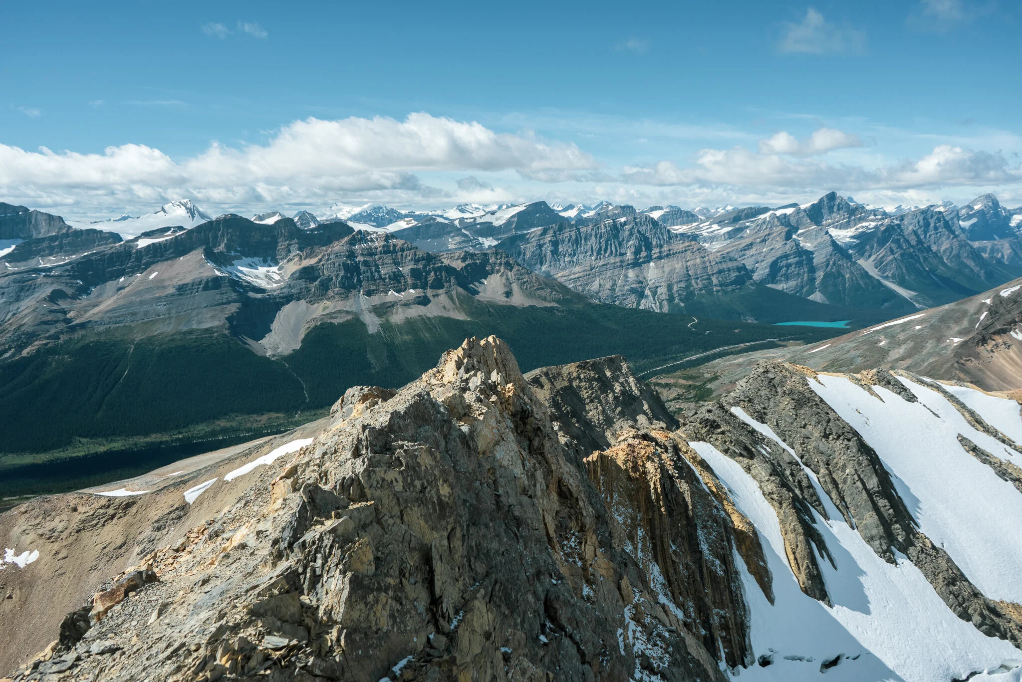
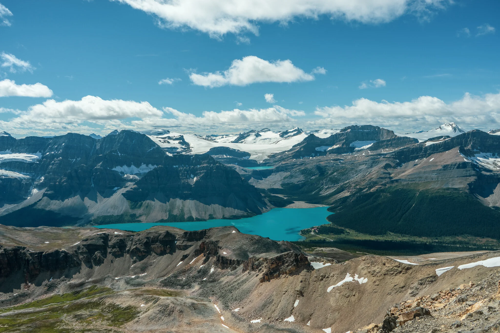
Northwest views of Cirque Peak, Peyto lake is on the right and Jimmy Simpson to the left.
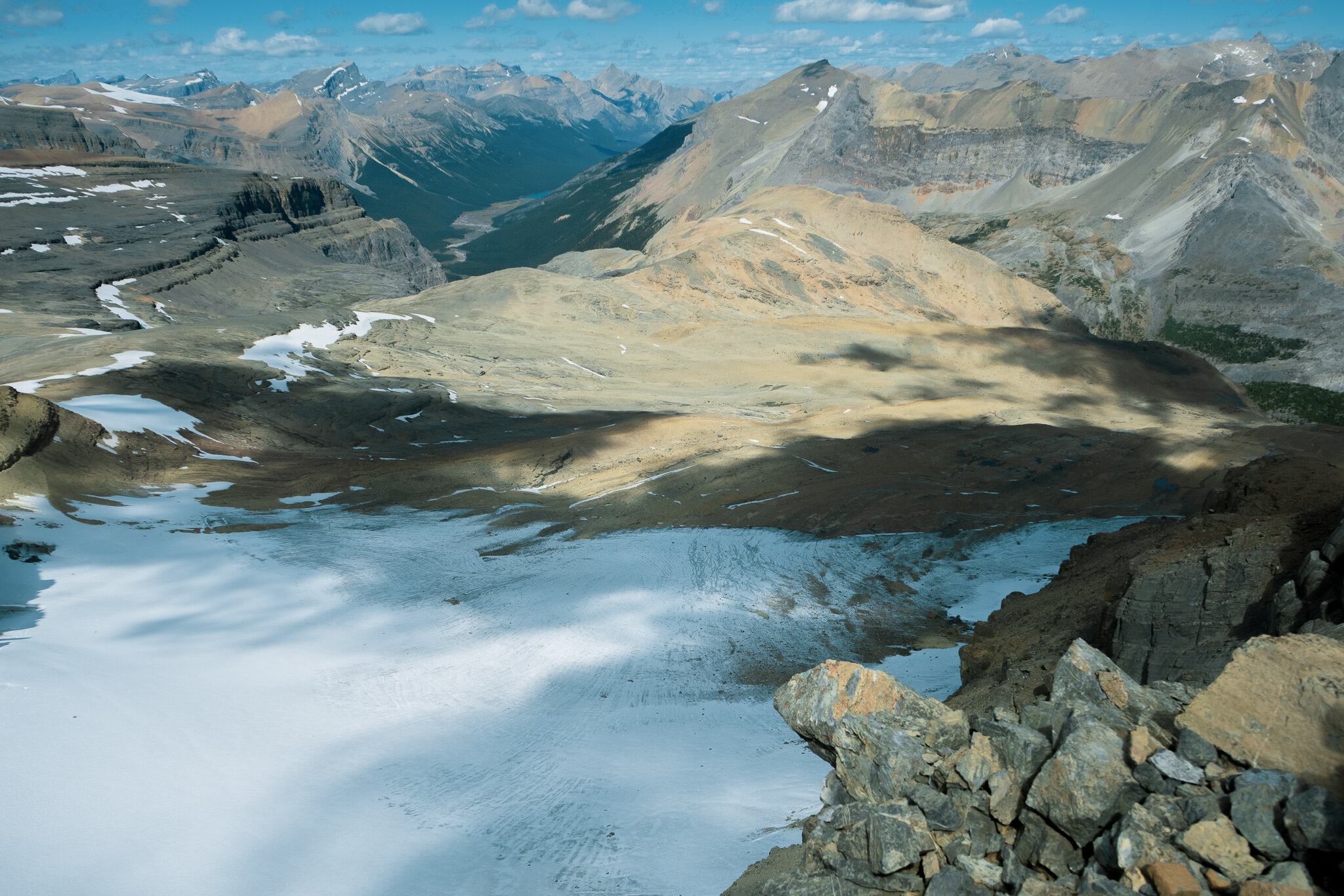
West views towards Bow Lake.


Wow, look at how far we’ve come.
North side of Cirque Peak, Great spot for a slide down? (I’m totally kidding).

Official summit.

Time to celebrate!

We made it! Huge thanks for those of you who joined me, Can’t wait to have you join me on the next one. Leave a comment! Tell me what you guys think!